
Creating a Community Destination.The Red Cedar Pathway is a river basin wide community initiative to preserve and protect the Red Cedar River and provide for the development of the Red Cedar River Water Trail. The initiative includes the following areas of focus:
|

|
|
1. River Stewardship: Cleanup and improved navigation.
2. Red Cedar River Water Trail Development: Promoting recreation and sport. 3. Research and Outreach: Water flow and quality monitoring. 4. Developing A River Community: River enthusiasts share activities, news, and special events. 5. River Long Celebration: Annual communities river celebrations. |
|
Mid-Michigan Rotarians Leading The Way.
|
Williamston, Haslett-Okemos, and East Lansing Rotaries are combining forces to make the Red Cedar River an outstanding regional recreational asset for mid-Michigan residents and visitors.
Williamston Sunrise Rotary President Laska Creagh, had the idea to make the Red Cedar a place where people can go to and drive up north. However, floating trash and log jams need to be mitigated, and improved riverside amenities are needed to improve access, recreation sports usage. Working with other Rotaries and clubs along the Red Cedar River Trail, including Boy Scouts and Girls Scouts, has resulted immediate improvements. |

Back Row (l-r): Keith Creagh (Williamston Rotary Satellite) John Bollman, (Williamston Rotary Satellite), Bill McMillen (MSU Rotaract), Bruce Wiggington (Williamston Rotary Satellite), Jason Burnette (Lansing Rotary), Peter Dewan (East Lansing Rotary). Front Row (l-r): Chris Abraham (Williamston Rotary Satellite), Laska Creagh (Williamston Sunrise Rotary), Sharon LaPointe (Williamston Sunrise Rotary), Mike Stout (MI Waterways Stewards). Not depicted: Christian Fairbanks (Haslett/Okemos Rotary).
|
|
|


|
Red Cedar Pathway in the news: Click here.
|
Follow us on Facebook, click here.
|
Partnering with Michigan Waterways Stewards
Michigan Waterways Stewards is proud to partner with Red Cedar Pathways. Our 2023 Red Cedar River goals are to:
|
|
To celebrate this accomplishment we envision a year-end, river-long, special event to showcase this prized Mid-Michigan river, recognize our valued partners, and promote community pride.
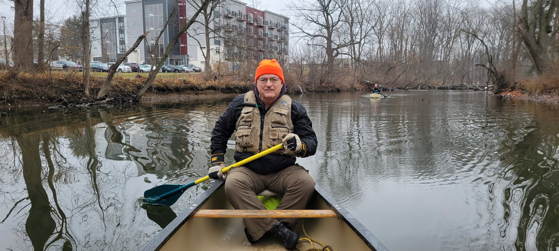
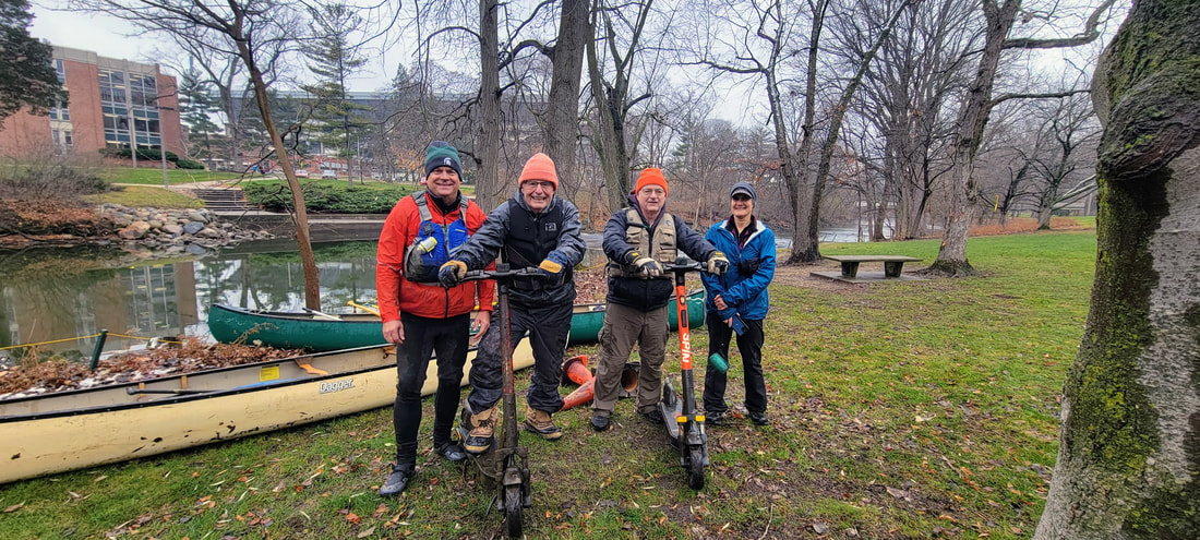
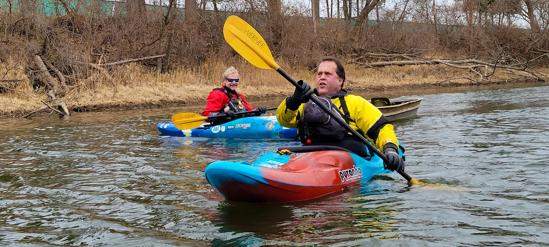
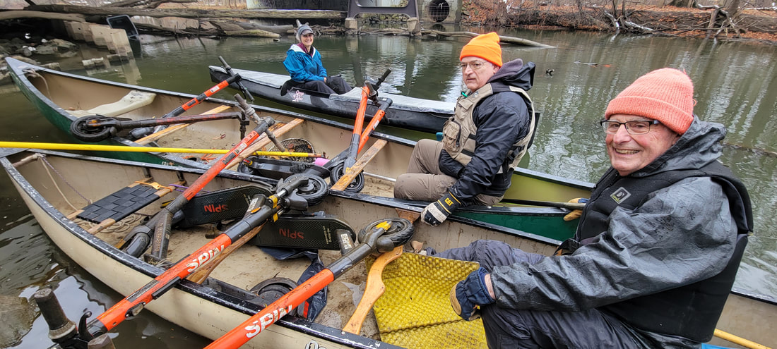
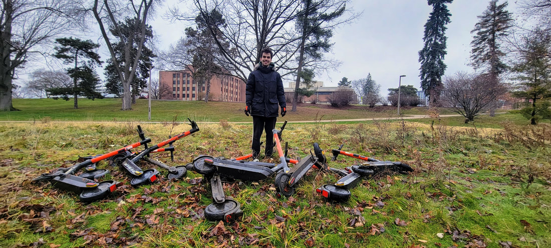
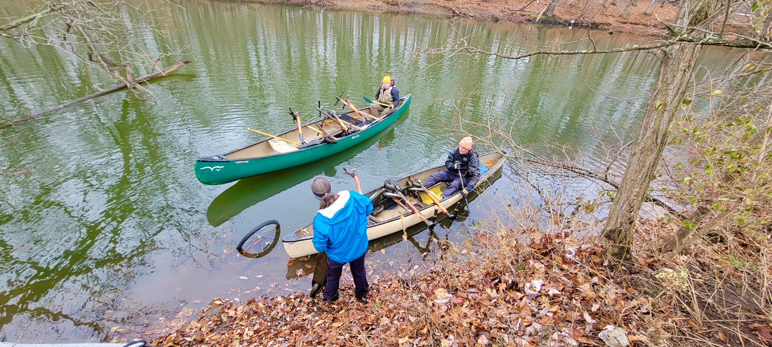
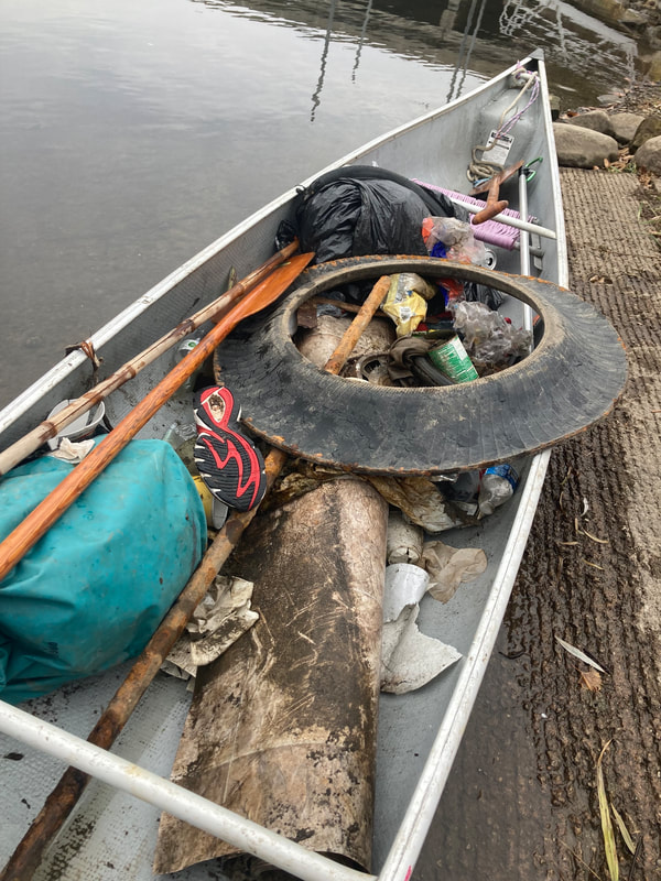
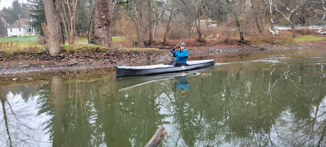
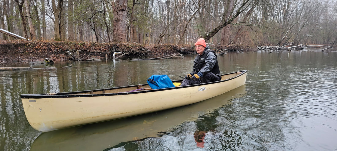
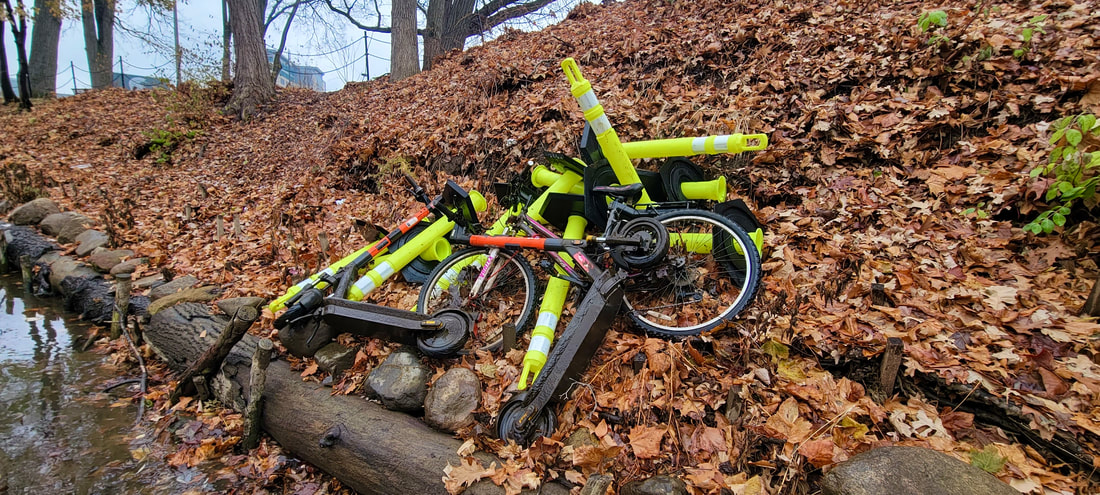
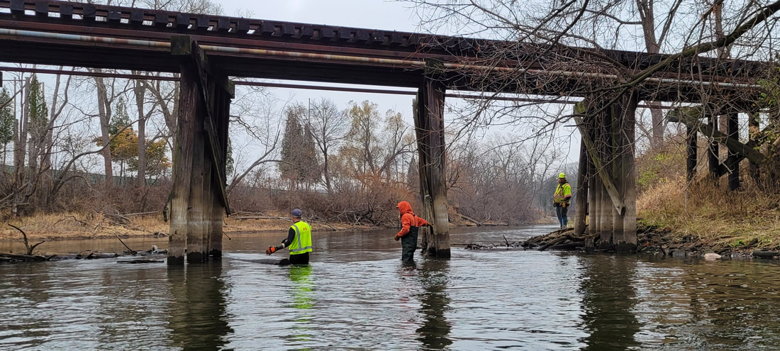
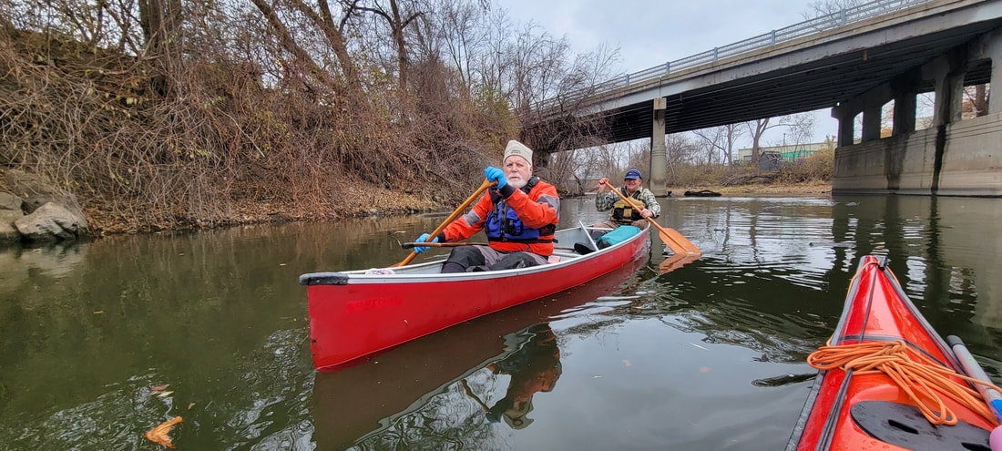
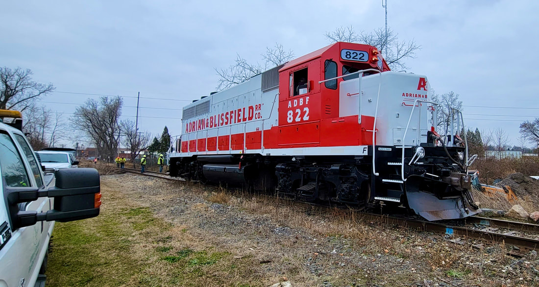
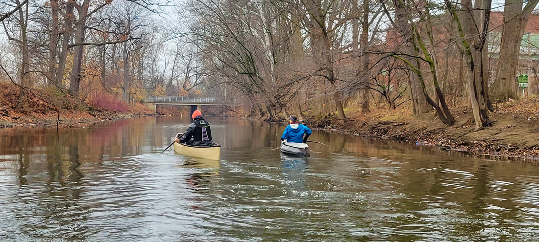
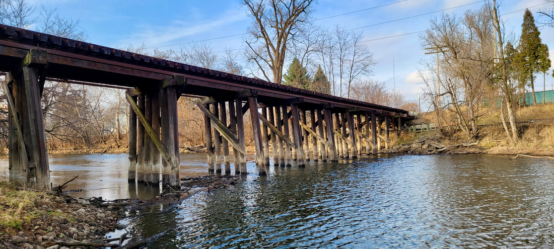
To view a few examples of recent Red Cedar River improvement initiatives, check out River Angels in action. Click on any image for a full view photo.
To view a few examples of recent Red Cedar River improvement initiatives, check out River Angels in action. Click on any image for a full view photo.
RIVER ANGELS IN ACTION - RED CEDAR RIVER

Mid-Michigan's Prized Red Cedar River

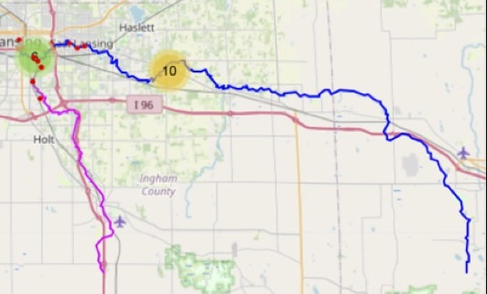
The Red Cedar River is a treasured, scenic, narrow, winding river which runs 51.1 miles. It is a thriving ecosystem and supports a variety of fish species and macroinvertebrates. Over 30 types of fish are found in the river, including bluegill, green sunfish, northern pike, largemouth bass and smallmouth bass. It is a popular river for seasonal paddling and floating.
The river begins near Cedar Lake in Marion Township in southern Livingston County. It flows northwest through Fowlerville, then west through northern Ingham County. In Ingham County it runs through Williamston, Okemos, East Lansing, and finally Lansing, where it empties into the Grand River.
The river begins near Cedar Lake in Marion Township in southern Livingston County. It flows northwest through Fowlerville, then west through northern Ingham County. In Ingham County it runs through Williamston, Okemos, East Lansing, and finally Lansing, where it empties into the Grand River.
As the Red Cedar passes through the campus of Michigan State University, on the north side you will find the five acre, W.J. Beal Botanical Garden, the oldest continuous botanical garden in the United States. The garden was started in 1873 and in 2023 the University will be celebrating it's sesquicentennial anniversary.
Red Cedar River Watershed
The Red Cedar River originates near Cedar Lake, which is located in the southwestern corner of Livingston County, in the south-central portion of the Lower Peninsula. The river flows in a westerly direction for about 51 miles from the area surrounding Cedar Lake, into Ingham County, through Meridian Township, the City of East Lansing and the campus of Michigan State University, and into Lansing, where it joins the Grand River.
The Red Cedar River Watershed, is approximately 294,496 acres (461 sq. miles) and land use in the watershed area is varied. The Red Cedar River has West and Middle Branches, which also originate in southern Livingston County.
To view a map of the Red Cedar River watershed, click on the image below.
The Red Cedar River Watershed, is approximately 294,496 acres (461 sq. miles) and land use in the watershed area is varied. The Red Cedar River has West and Middle Branches, which also originate in southern Livingston County.
To view a map of the Red Cedar River watershed, click on the image below.
| rcrw_map.jpeg |


|
Michigan Waterways Stewards Stewardship • Education • Advocacy
We are a federally tax-exempt Michigan nonprofit corporation. EIN: 92-1772858
Copyright © 2022 Site created by i3 Marketing, LLC.
|
|